The difference between the two river is the: Jamez Brewer
1: the schuykil runs into philadelphia
2:the schuykil is smaller'
3:the schuykil is not as clean
4:the schuykil is not use as much as the delware
5:the schuykil doesnt have ports like the delware
The similarities are:
1:they both run through philadelphia
2:they both should have a source of fish
3:they both have places where people can play
4:they both have a something down there to draw alilttle attention
5:the delware has peirs
Wednesday, July 28, 2010
Penn Landing
* there was two diffent piers one was a apartment that look dirty to me but it seem like many people like it because it showed a view of the river and the was another peir that they was building to make a park for people to sit at
* i think that they choose these uses for more people to come there and also to make it look better
* i like the experence of being at Penn Landing better than the schuylkill river because it seem more natrul and nice
* 1. the schuykill rive runs in the philadelphia
2. penns landing separate philadelphia and delaware
3. penns land has Dav & Busters
4. the schuykill river run into the art museum
5. the schuykill river has i bike trail
delaware river waterfront
yesterday we went to penn's landing to the delaware river waterfront.we had a lot of fun that day an we learning a lot from the trip. we learning and saw how the piers was use back then and now.they are used for apartment,parks,little cafes ,and restaurants. they was along the river because it was faster to get them by boat then by something else. the experience was a good experience because i always go to penn's landing but i never know that they use the river for piers. the experience was different from the time we went to Schuylkill river because there was a lot of bikers and running at the Schuylkill and there was none at the Delaware river.
pennslanding trip
yesterday me and my coworkers caught the sub and "L" train to Pennslanding. it was probabally the best trip. I had tons of fun looking at maps of my city and learning about the trees in out city that are mostly seen. we saw all the piers and how they're used now and how they were used then. over all it was a great trip in which i learned a-lot!
-most piers were used for parked boats , restaurants , -state and apartments
-well pennslanding had more space and more things to do and look at while we were there. Not as many bikers and joggers to interfere with our walk and risk getting ran over.and the experience was great to learn so much about a place that i enjoy going to.
The Delware Water Front
The way the piers were being used is the people were sometimes riding bikes or walking along the trail looking at the river and the other things around it. The owners of the docks sometime tried to start a construction like of a park to draw attention to the park. Then some men tried to make different ways of not letting the water go down on the side walk and fall down to the sewer.
These uses were used along the river because this is where they use to load cargo and ship out different things that were made in the philadelphia factory's.the experience was not that different from any other time I've been there.
These uses were used along the river because this is where they use to load cargo and ship out different things that were made in the philadelphia factory's.the experience was not that different from any other time I've been there.
Penn's Landing *
Our trip at Penn's Landing was a little fun . There were piers being used as resting areas, scenery for picture takers, apartment buildings , restaurants and Dave & Busters. These places were along the river because it attracts people. At Penn's Landing it was a better experience than being at the Schuykill Banks Trail because it was a lot more shade , a place to get food&snacks , Water Fountains , more spacious and a lot more resting areas . Penn's Landing also had maps of various things such as Trees In Philadelphia , Maps Of The City Of Philadelphia and different colors for each and when it was made.
Milan*
Milan*
Monday, July 26, 2010
Trip to the Wissahickon
Last Friday we went on a trip to the Wissahickon Park. We walked along the trails and looked at the creek and the nature in the park.


Pictures from the Art Museum
Last Thursday the remaining groups went to the Philadelphia Art Museum. We looked at the armor, European art, modern art, and American art and compared the way the interpreted nature.


Museum Of Philadelphia
The Trip To The Art Museum Was The Longest And Hottest Trip Yet ! We Walked From 30th Street All The Way To The Art Museum Along The Schukyll River . The Schukyll River Wasn't Very Clean But It Was Not As Bad As The Wissahickon Creek. There Was A Nice Breeze To Help Me Keep Going. The Hill We Had To Walk Up Was Very Steep ! It Was Hard To Walk Up The Hill In The Hea But We All made It. Once We Got To The Art Museum I Was So Hot And Tired. We Had To Wait Outside Because We Were Almost 10 Minutes Early. While Waiting Me And My Group Took A Picture. When We Finally Were Allowed To Go In The Museum We Sat Down And Relaxed For Awhile. We Saw Many Different Paintings , Sculptures And Armor. When We Were Leaving I Was So Hungry ! It Was Nice To See How Artists' Express Themselves. The Trip Was Nice .
Art museun
Another trip that we went on last week was the to the art museum where we saw plenty of interesting things.Like one thing we saw was the war equipment where there was guns, swords ,armmor and different types of defense weaponry. then we saw different types of art work like impression , scenery. the art museum was a okay trip and but the way we got there was like torture .the overall trip was excrustating. this trip was poping
Art Museum
We caught the subway n the market frankford L to the museum.They had alot of art from the 1800's. Also they had alot of armor from the wars back in the day. Another thing is that they had alot of nice paintings. Also there were 60 people from the program who attended the trip. One other thing is that i enjoyed seeing the chinese tea pot house. It was a far walk from the train.
art museum
that day was full of suprises but fun. we walked on kelly drive to get there , which was totaly unexpected. however while we were there i seen many beautiful paintings and sculptures. these paintings and statues had many significant meanings and great painters. but the mmost amazing things that i seen were the woden furniture and silver spoons from wealthy people houses and most of all the tea house they imported from china and resembled back together. the reason why is because for the simple fact that they remembered exactly how it was in china and was able to come back to the U.S and remake it was awesome! in conclusion it was about 30 of us and we had a great time with the mentors and ryan!
Wissahicko park
At the Wissahickon park they have 100 steps before you enter the park. Also the park have alot of bugs. Another thing is that we had to take the septa regional rail. At the wissahickon park there is a cave when you walk thru the trail. Also there is alot of people that ride there bikes down there. One other thing is that the water there is dirty the color of it as green.
When arrived at the wissahickon park we saw 100 steps then as we proceeded down the steps we were tired.Then we saw dirty water in the creek then we saw the dam we there were twigs and logs on the banks. then we went further down the path were we saw a path that lead to a cave at the top .Then as we waited for the other groups to cross the bridge some man and his family cam across the bridge to but with a dog so the dog bits one of the Students/Workers were bitten.
trip to the art museum and wissahickon park
last thursday and friday we went the the art museum and to wissahickon park on both days it was hot and sweat.there was 30 kids that went to the art museum and 60 kids the went to the wissahickon. while we was at the art museum we look at some important paints and statues. some of us took picture of some of the paints.we had a good time at the art museum.while we was at the wissahickon park we had to walk down 100 steps .at the park we saw that the water was dirty.while we was walking we saw how some of the water was not dirty.there are animals that live in the dirty water like ducks.then we saw that a lot of people use the park to walk,ride there bikes,and jogged.then they have us walk up this step hill to see a cave that i didn't get to see because something happen .
The Art Museum
We first started by gathering everyone up at the subway at Cecil B. Moore and then getting of at city hall with 30 people. Next we had got on the L train and got off 30th street. After that we all had to go down the steps and walk along the schuylkill river which lead us to the art museum. So when we got there i met a lady name Tina who gave my group a tour of the art Museum. My favorite place in the museum was were the knights and the weapons were at, but overall the trip was fun.
Wissahickon Park Trip *
The Wissahickon Park Trip Was Very Hot ! To Get There We Had To Take The R6 Train. When We Got Off The Train It Was A Long Walk To The 100 Steps We Had To Walk Down Just to Get To The Trail. At First I Was Really Scared , The Steps Looked Very Steep But After I Walked Down Them I Learned They Weren't As Steep As I Thought. The Water Was Very Dirty. It Had A Dirty Green Color To It. Although It Was So Filthy Fish Were Still In It And Alive ! That Amazed Me to See How Such Animals Could Survive In Such A Nasty Habitat. The Water Was So Shallow That I Could See the Bot tom Of The Creek. It Was very Green In A Good Way Too. There Were So Many Trees And Plants Around There .While Walking The Trail People Were Walking Dogs With Their Families , Jogging By And Riding There Bikes By Us Really Fast So We Had To Be Careful Not To Get Hit. I Saw Two daddy Long Leg Spiders Crawling Across The Trail Which Made Me Jump A Little. The Park Has Help Locators With Different Numbers For Different Areas Of the Park So If Anyone Gets Hurt Or Needs Help The Police/Ambulance Knows Where To Come . Even Though It Was Really Hot And Sweaty It Felt Good To Be Out In The Fresh Air.
Milan*
Wednesday, July 21, 2010
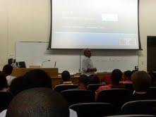
John Street's Visit
Former mayor John Street came today to talk to all of the people in the BITS program. John Street was very funny and it seemed like he cares about us. He asked different students to come to the front of the auditorium to demonstrate different things. Naeem was one of the students who went up there and participated in the laughing contest. He made it to the end up laughed at last minute. He still gave him a prize though
Here are some pictures from the day:


Here are some pictures from the day:


Tuesday, July 20, 2010
comparin our neighborhoods from seventy years ago
Today we compared two maps of our neighborhoods. One map was from the 1930’s compared to the most current way. i expected that a-lot would have changed. However there were not many. the only thing that has really changed is the stores all of the houses were still there! Most of the churches are new and few are old.
map in the 1930's and now
today we look at 2 different maps of her community one in 1930 and now.when i look at the 2 maps i had two changes about my community they are that there were more house in the 1930 map then the new one also there were more tress back then.
My Neighborhood Of 2010
Things That Have Changed Around My Neighborhood Is :
* More trees
* More Houses
* More Stores On Stenton Ave
* Cars Are On the Streets
* More trees
* More Houses
* More Stores On Stenton Ave
* Cars Are On the Streets
Milan*
Maps
In the computer lab we worked on maps so we compared older maps with newer maps so i found out that back then there was not as many tress and nature back then there it is now.
Monday, July 19, 2010
Parkway
I think parkway should have more tress so it can be more shade. Also because it will make the city look better. Another thing is that they should have more resturants to eat at. One other thing is that they should have a public park . That's some reasons how i think Parkway will get improved.
Parkway recommendations
by:ryneik coachman
Parkway recommendations!
The parkway is a great place with many historical sites. however some things could be changed. for instance it is a really long excruciating walk when it is hot out , but we also want to see all the historical landmarks and figures. therefore i recommend a small parkway bus for people to get on but have to pay so that they could get a ride and see sites.
reasons why?
-comfort(shade from the heat):so our legs wont hurt from walking
-more tourist attraction: more people would come because now they do not have to walk and enjoy the sites but be relaxed and enjoy them!(isn’t that nice!)
-less people walking:therefore on big events not as many people will be walking
-safer: no hurting yourself on sticks , high pavements and from the homeless people that walk the streets and wash in the ountains
who it will benefit?
This will benefit everyone especially the walkers!
Powerpoint Presentations on Wissahickon Park
On Friday, our group researched different topics on the Wissahickon Park. We researched the types of animals that live there, the history, the environmental problems in the park, the areas around the park, the waterways, and the constructed features in the park. Here is the information we collected:
Naeem:
Elijah:
James:
Chris:
Milan:
Ryneik:
Naeem:
Elijah:
James:
Chris:
Milan:
Ryneik:
Recommendation
To improve the parkway, I would add more benches and trees. You can sit under the trees for shade. It be too hot outside to be walking around. I picked benches because people get tired of walking down the parkway. The people can get like a 5 minute rest sitting down on the benches. The benches can go under the trees. While you resting, you'll be in the shade. It would benefit the people thats out there walking.
Parkway Recommendation
I really like the Benjamin Franklin Parkway but there is one thing I think its missing it's missing. I will like to recommend them to add more sitting areas. One reason I choose this because there is a lots of people who goes down there so there is not enough places to sit in the park. Next, older people need to sit down a lot. Another reason is that people who run on it need to rest. Furthermore, it will make it more user friendly so more people will show up. Last it will look more like a public park.
Park way Ball courts
My recomendation for the park way is to have basketball courts . The reason i would recomend basketball courts to be added to the parkway is because it would make more people come down to the courts on park or if you were tired of see the dame things every time you go down parkway you would go play a little basketball for a minute. Another reason i choose basketball as my recomendation is because the basket ball courts are a way people come to meet and chill i think it would bring more visitors .Just say someone might say mom can we go to philly i want to check out the basketball courts on the parkway. My last reason i choose basketball courts is because maybe someone decided to start a outdoor basketball league down downtown they wouldnt have to go far because they would have to just go down parkway and that would draw kids from the city to the come play ball.
Parkway's Improvement *
To Improve The Parkway I Would Add More Hotels. Some Reasons Why I Would Add More Hotels Is So More People Could Visit Philadelphia With Out Worrying About A Place To Stay Far From The City. Hotels Also Have Restaurants Inside So People Who Aren't Even Staying Over Night Can Go Out To Eat Without Waiting In Long Lines For A Table Because Of The Few Select Restaurants And Hotels On The Parkway. Hotels Also Have Starbucks Or Small Coffee Shops And Cafes. These Small Cafes Have Air Conditioner In The Summer And Heat In Winter Which Accomadates Peoples Needs. Bathrooms Are Usually Available To People That Buy An Item At Cafes. Hotels Would Make The Parkway More Up To Date .
Milan*
I have one recommendation and 5 reason why it would improve the parkway.my recommendation is they should have more sitting place for people to sit.my first reason why is because if visiter from other country or city was to come to the parkway an they want to sit fora min .they would not have a place to sit because there is no place t sit. my second reason is what if a school gave a trip to the parkway an they was walking all day.they want to sit down they have to go all they way to the art museum to sit down.my third reason is that while you down parkway an its hot and was walking seen you got there .there is no where you can sit.my fourth reason is that people have problem with they legs .they want to sitting in rest there legs for a while an look at the parkway.there is no where to sit.my last reason is what if it's really hot out an u was walk through parkway you feel like you was about faint. you need to sit bet there was no where to sit at .
Friday, July 16, 2010
Research on Wissahickon Park
Yesterday we researched information about the Wissahickon Park since we are going there next Monday. Here are some of the things we found out:
Ryneik:
It was founded in 18698 and added to Fairmount Park in 1855. You can catch the one bus to get there.
Charlsey:
You can find it in Montgomery Country. It runs 23 miles. You can catch the regional rail to get there. The history about the creek is that in 1694 Johannes Kelpius arrived in Philadelphia with a group of like mind.
Milan:
Wissahickon Creek Is In Montgomery County In Pennsylvania. It Runs 23 Miles Passing Through Northwest Philadelphia And Is Now Apart Of Fairmount Park. If You Wanted To Get To Wissahickon Creek You Would Take The Regional Rail Train R6. This Park Is Used By Many People. Children Go Here To Rides Bikes , Jump In The Lake And Have Fun With Family And Friends. Adults Go To Ride Bikes , Jog Or To Simply Take A Nature Walk. During 1687 Thomas Holmes Made A MAp Of How They Wanted To Build The Park.
James:
The Wissahickon Creek is a stream in southern Pennsylvania .it is in Montgomery county and it runs about 23 miles.It pass through and divide northwest Philadelphia before emptying into the Schuylkill river at Philadelphia. its watershed cover about 64 miles. The way u get there from septa is regional rail train. the creek used to be a place where a man formed a group and they used to come there as a resting spot and meditating spot. the park was natural.
Naeem:
The park is located in Fairmount Park. You can take the R6 to get there. In 1934 FOW came to the rescue. The park is used for the public to have fun in. It was built in 1924
Elijah:
Wissahickon Park is near West Mount Airy & is apart of Fairmount Park. You can get there by catching the SEPTA bus. When colonists arrived in the mid - 1600s, the hunting and fishing grounds of the Indians were transformed into the first industrial area of North America. Its a community park. Its was built in 1924.
This map shows the trail we will be taking at the Wissahickon Park!!!
View Wissahickon Walk in a larger map
Thursday, July 15, 2010
Campus vegetation Exploration
today we went on a little nature walk through the campus of temple. While we were walking we had to find some leaves. Then we came to the classroom & tried to identify the leaves.also we made a google map of where we found the leaves.
View campus vegetation in a larger map
View campus vegetation in a larger map
in general
bits is a great program that i am enjoying so far. I t is helping m to get used t the working world. I am considering coming back next year for internship.I learn alot about my city and its history at work each and every day.
Wednesday, July 14, 2010
World Rivers
Today we learned about the different rivers around the world. We learned about rivers in Canada, Europe, Asia, and Africa. We also played a little trivia game to see which team in our group knew the most about rivers. Here are some of the things we researched:
the Niger River:
The Niger rive is the 11th longest river at 2,590 miles, it is the largest in western AFrica. It begins in guinea and runs east through Benin, Guinea, Mali, Niger, and Nigeria. Oil is the main income from the river, it is a major oil producer. The fish in the water are sources of people that live nearby, this river has many dams! The largest dam which is the Kainji dam, which was built to protect against flooding and hydroelectric power. the middle of this river was a focal point for trade across the western Sahara!

written by Ryneik
Tigris River:
The tigris is in three countries and the countries are Iraq, Syria, and Turkey. The poeople in this area of the river use the rivers as an enrichment for the agriculture outside. They use dams as a way of averting floods in Iraq. In Turkish the subject of dammin has been some what a subject of controversy. The tigris is also used a transport route for the largely desert country.

written by James
the Nile River:
The Nile River crosses about 6 kinds of countries and it is about 4184 miles long which mean that is the world's longest river. Next it is usually known to belong to egypt even though it crosses to many other places. Also it was used by the ancient Egyptians they used it for to get soil and spring foods. Sometimes the Nile river can over flow banks by it. There are many animals that lay there nest at the Nile River too. Last the river is about 4 meter deep.

written by Naeem
The Nile River is the longest river in the world. The river is 6695 kilometers (4184) miles) long. The Nile ahs been the lifelilne of civilization in Egypt since the Stone Age. One of the river's abilities is that it produces extremely fertile soild which made it easy for cities and civilizations to spring up alongside the banks of the Nile. People use the river to wash their clothes, for drinking, transportation, etc.

written by Chris
The Nile River is the longest river in the world. Also the Nile have two major tributaries, the While Nile and Blue Nile. Also the Nile River runs 1,545 kilometers through Egypt. The Nile River is know in Egypt. People use it to go on cruises and vacations. Most people who take a trip to Egypt always go to the Nile River

written by Elijah
The Thames River:
the Thames river is the longest river in England. It have 45 locks. It is the home fo 25 species of fish. The Thames river travels over 210 miles through the heart of some of England's most picturesque towns. The residents use it by going rowing, sailing, skiffing, punting, kayaking, canoeing, and meanders

written by Charlsey
the Seine River:
The Seine river flows through Paris. In the 1900s the Seine river hosted the rowing, swimming, and water polo events. At one point the Seine river was Paris' main route for transportation and protection. Now it is used for tours. Along the Seine River are old bridges and historical landmarks. Many people take a boat tour to view the beautiful parts of Paris that surrounds the Seine River.

written by Milan
scavenger hunt
Me and my fellow coworkers had a great time with our mentor Marissa Wineburg looking for landmarks on the temple campus. During the hunt we learned how long these places existed. For instance the Tech center was there for 5 years. on the other hand i learned something that really grabbed my attention , which was in the Founders garden! I had found that a man was buried in that very place in 1925.
Tuesday, July 13, 2010
Map of the Parkway
this is a map of the Parkway. It shows some of the statues we saw on the walk. Naeem made this map:
View The Parkway in a larger map
View The Parkway in a larger map
Maps of the Scavenger Hunt
We went on a scavenger hunt last week. These are some of the maps of the locations we looked for. If you click on the different points on the map you can see what the location is, who uses it, and what the purpose of the landmark is
James:
View Scavenger Hunt in a larger map
Charlsey:
View scavanger hunt in a larger map
Chris:
View Scavenger Hunt in a larger map
Naeem:
View Scavenger Hunt in a larger map
Ryneik:
View scavenger hunt in a larger map
James:
View Scavenger Hunt in a larger map
Charlsey:
View scavanger hunt in a larger map
Chris:
View Scavenger Hunt in a larger map
Naeem:
View Scavenger Hunt in a larger map
Ryneik:
View scavenger hunt in a larger map


Benjamin Franklin Parkway
Yesterday July 12 , 2010 me and my coworkers went on our first field trip , which was the Benjamin Franklin Parkway. We walked all the way from city hall there iht was a very hot , exhausting , but memorable walk! We had a great time learning about the history of the Parkway and admiring the statues. my coworkers and I learned what the statues mean! for instance the statues in the Logan circle of the man , woman , and girl. those statues were symbols of the Wissahickon , Delaware , and Schuykill rivers. That was very neat and creative!
Parkway
First we all met in the student center then we met up with another group then we were off. So then we went to the subway after a few minutes we were there .When we arrived we went over to love park and met up wit a women. Then we went to the subway to get something to eat on the trip down parkway. Then we started off by going to the logan square where they use to kill criminals .Then we went down to the rocky statue and after we saw that we went up the steps and sat down for a minute and then we to a photo. Then we left the steps we went back to love park to talk about the interesting things we learned .Then we left and got on the subway and went home that was the park way trip
Parkway Trip
The Parkway Trip Was Overall A Good Experience. I Saw Many Statues That I Never Payed Attention To And Learned About What It Was Of And Who. While There We Ate At Subway And Walked Up All The Steps At The Art Museum Just Like Rocky Balboa . The Trip Reminded Me Of Nature Walk But I Enjoyed Our Little "Nature Walk"
:) Milan *
:) Milan *
Parkway
The Parkway trip was nice. I think it should have more resturants & parks.Also I learned that Logan Square changed into Logan Circle. Another thing is that Parkway is about to have bike lanes.
Parkway
The trip to the Parkway was nice. I learned a couple things about the monuments. I ran up the art museum steps for the first time. It was a good experience going down there.
Parkway Trip
On july 12 the bitts group to went to the parkway. It stated by meeting up at love park. Witch is my favorite part of the parkway. Then we started our walk by going to see a map of philadelphia. Next, we visited logan square where i learned that it use to be a place where they killed people at. Last we ended walking to the art museum.
trip to the ben franklin parkway
yesterday we went to the parkway.we walk from city hall all the way to the art museum.while we was walk we stop at a few water fountain and statue on the way.also we was answering question about what we see during are walk.it was hot and sweat but we still had fun running the art museum step just like rocky did.then we was getting mad because we had to walk all the way back to city hall.while we was on our trip we had to collect water simple and leaves. so we can see what was there names and what was in the water.that is what we did on our trip to the parkway.we have to go back to parkway again i want to see how that goes
Thursday, July 8, 2010
Google Maps and Landmarks/ Scavenger Hunt
Today we did a lot of activites. The first activity that we did was that we made google maps of our community and added some landmarks to them. Here are some of the questions we wrote about our landmarks and our maps:
-What is the landmark called?
-write directions for a visitor to find it
-how is it used by members in the community
-what was its history? who do you think built it and why?
Tyie DeBeary:
It's my house. from my house to get to my cousin's you would catch the 33 trolley to 19th and market. Then ou would wak to 19th and JFK blvd and get on the 33 bus to 22nd and cambria. then you would walk down cambria towards 21st until you get to van pelt st and make a left. its the first house on the left. It is used because people know where i live and i have the only red door on the block. i don't believe that my house has any important history.
Ryneik Coachman:
The landmark is called the Graysferry Bridge. the way that you get to Graysferry bridge from my house, which is 20th and wilder street is very easy. First you will make a left at the end of my block and keep going straight until you reach twentieth and Tasker st. Secondly you make a right on tasker and go straight until you reach 33rd st. then on 33rd street you will see an open street that leads to the schukyll expressway.
Naeem Brown:
The landmark is called LOVE Park. if you start at the liberty bell go up 6th street, take a left at market, then take a right at Penn Square, last take a left and your there. it's used by looking for other landmarks to help get around. I don't know about the history
Eliljah Jennings:
the landmark is Chew Playground. it's at 18th and Ellsworth. You can take the 17 bus. People play basketball, pool, walk the dog, and bring their kids there.
James Brewer:
This is a map of landmarks in the neighborhood
View My Neighbor hood in a larger map
The next activity that we had was a scavenger hunt around campus. Some of the places we went to were the founder's garden, Pollett Walk, Anderson Hall, the Tech Center, and the Student activities center


Wednesday, July 7, 2010
Day 2 of the Program
Today our group got to learn a little bit more about each other. We also did some fun activities throughout the day. We all drew maps of our community neighborhoods and labeled some of the important landmarks such as basketball courts, stores, and small deli shops. We also learned more about maps and how we could have improved the maps we drew.
Subscribe to:
Comments (Atom)